NCERT Class 6 Geography Chapter 2 Notes Globe Latitudes and Longitudes

On this page, you will find NCERT Class 6 Geography Chapter 2 Notes Pdf free download. CBSE Class 6 Social Science Notes Geography Chapter 2 SST Globe Latitudes and Longitudes will seemingly help them to revise the important concepts in less time.

Globe Latitudes and Longitudes Class 6 Notes Social Science Geography Chapter 2

CBSE Class 6 Geography Chapter 2 Notes Understanding The Lesson

1. The shape of the Earth can be understood by the globe. The globe is an imaginary shape of Earth.

2. Two points on the globe through which the needle passes are two poles – above side the North Pole and below side the South Pole. Both pins of globe can be imagined as ‘axis’. The globe can move towards west to east, as the Earth moves.

3. Another imaginary line running on the globe divides it into two equal parts. This line is known as the northern half part is called the Northern Hemisphere and southern half is called the Southern Hemisphere.

4. All parallel circles from the equator up to the poles are called parallels of latitudes. Latitudes are measured in degrees.

5. All parallels north of the equator are called ‘north latitudes’. Similarly, all parallels south of the equator are called ‘south latitudes’. Generally, this is indicated by the letter ‘N’ or ‘S’.

There are four important parallels of latitudes:

  • Tropic of Cancer   –   23 1/2°
  • Tropic of Capricorn  – 23 1/2°
  • Arctic Circle   –    66 1/2°
  • Antarctic Circle – 66 1/2°

6. The area between the Tropic of Cancer and the Tropic of Capricorn receives the maximum heat and is called the Torrid Zone.

7. The area between Tropic of Cancer and the Arctic Circle in Northern Hemisphere and the Tropic of Capricorn and the Antarctic Circle in the Southern Hemisphere have moderate temperatures. These are therefore, called Temperate Zones.

8. The area of Arctic Circle of both side towards the North Pole as well as the South Pole are called Frigid Zones. These areas are very cold.

9. The Prime Meridian represents zero degree longitude. The longitude in the Eastern Hemisphere are designated at degrees east such as 10°E, 20°E, 30°E and so on till 180° and similarly in Western Hemisphere.

10. Degrees are further divided into minutes and minutes into seconds. Minutes are shown as single apostrophe (‘) and seconds are shown as double apostrophe (“).

11. When the Prime Meridian of Greenwich has the Sun at the highest point in the sky, all the places along this meridian will have mid-day or noon.

12. The Earth rotates 1° in four minutes, 15° in an hour and thus 360° in about 24 hours.

13. The local time of places which are on different meridians is bound to differ. It is, therefore, necessary to adopt the local time of some central meridian of a country as the standard time for the country. In India, the longitude of 82 14 °E is treated as the standard meridian. The local time at this meridian is taken as the standard time for the whole country. It is known as the Indian Standard Time (1ST).

Globe Latitudes and Longitudes Class 6 CBSE Notes Important Terms

Globe: It is true and imaginary model of the Earth.

Geoid: It means shape like the Earth.

Axis: It is an imaginary line. Earth rotates on Axis.

North Pole: North end of the Axis is called the North Pole.

South Pole: South end of the Axis is called the South Pole.

Longitudes: The lines running in north-south direction joining with the North Pole and the South Pole.

Latitudes: These lines are drawn parallel to the equator and are called Latitudes.

Equator: It is an imaginary line on globe, west to east and divides the Earth into two equal parts.

Torrid zone: The area between the Tropic of Cancer (23 1/2° N) and the Tropic of Capricorn (23 V2 0 S) is called the Torrid zone. Equator lies in the middle of the Torrid Zone.

Frigid Zone: An area of the Earth which is very cold, where Sun rays are always slanting and provides less heat is called Frigid Zone.

Prime Meridian: It is the 0°’ longitude and divides the Earth into eastern and western hemispheres.

Greenwich Meridian Time: It is the meridian passing through Greenwich in London. The local time of all places is linked to the Greenwich Meridian Time.

NCERT Class 7 History Chapter 10 Notes Eighteenth-Century Political Formations

On this page, you will find NCERT Class 7 History Chapter 10 Notes Pdf free download. CBSE Class 7 Social Science Notes History Chapter 10 SST Eighteenth-Century Political Formations will seemingly help them to revise the important concepts in less time.

Eighteenth-Century Political Formations Class 7 Notes Social Science History Chapter 10

CBSE Class 7 History Chapter 10 Notes Understanding The Lesson

1. Significant happening occurred in the subcontinent during the first half of the 18th century.

2. Boundaries of the Mughal Empire were reshaped by the emergence of a number of independent kingdom.

3. The British had successfully grabbed major chunks of territory in eastern India, by 1765.

4. The Mughal Empire started facing a variety of crises towards the closing years of the 17th These were caused by a number of factors.

5. Emperor Aurangzeb had depleted the military and financial resources of his empire by fighting a long war in the Deccan. Under his successors, the efficiency of the imperial administration broke down and it became difficult for the Mughal emperors to keep a check on their powerful mansabdars.

6. Nobles appointed as governors (subadars) often controlled the offices of revenue and military administration (diwani and faujdari) as well. As the governors consolidated their control over the provinces, the periodic remission of revenue to the capital declined.

7. In the northern and western India, the Mughals faced many rebellions including revolts of peasant and zamindari. These groups were now able to seize the economic resources of the region to consolidate their positions. After Aurangzeb, Mughal were unable to arrest the shifting of political and economic authority into the hand of provincial governors, local chieftains and other groups.

8. Ruler of Iran, Nadir Shah sacked and plundered the city of Delhi in 1739 and took away immense amounts of wealth.

9. Afghan ruler Ahmad Shah Abdali invaded north India five times between 1748 and 1761.

10. The worst possible humiliation came when two Mughal emperors, Farrukh Siyar and Alamgir II were assassinated and two others Ahmad Shah and Shah Alam II were blinded by their nobles.

11. With the decline in the authority of the Mughal emperors, the governors of large provinces, subadars, and the great zamindars consolidated their authority in different parts of the subcontinent.

12. Through the eighteenth century, the Mughal Empire gradually fragmented into a number of independent, regional states.

13. States of the 18th century can be divided into three overlapping groups:

14. States that were old Mughal provinces like Awadh, Bengal and Hyderabad. They were extremely powerful and quite independent, the rulers of these states did not break their formal ties with the Mughal emperor. All three states were founded by members of the high Mughal nobility who had been governors of large provinces-Sa’adat Khan (Awadh), Murshid Quli Khan (Bengal) and Asaf Jah (Hydrabad). All three had occupied high mansabdari positions and enjoyed the trust and confidence of the emperors. The two of them had zat rank of 7,000 each.

15. States had enjoyed considerable independence under the Mughals as watan jagirs. These included several Rajput kings.

16. States under the control of Marathas, Sikhs and others like the Jats had seized their independence from the Mughals after a long-drawn armed struggle.

17. Amber and Jodhpur had served under the Mughals. In exchange, they were permitted to enjoy considerable autonomy in their watan jagirs.

18. Ajit Singh, the ruler of Jodhpur, was also involved in the factional politics at the Mughal court. He held the governorship of Gujarat and Sawai Raja Jai Singh of Amber was governor of Malwa.

19. Sawai Raja Jai Singh founded his new capital at Jaipur and was given the subadari of Agra in 1722.

20. The Sikhs organization helped in regional state-building in the Punjab. Several battles were fought by Guru Gobind Singh against the Rajput and Mughal rulers, both before and after the institution of the Khalsa in 1699.

21. Several battles were founght by Guru Gobind Singh against the Rajput and Mughal rulers.

22. Under Banda Bahadur’s leadership Khalsa declared their sovereign rule by striking coins in the name of Guru Nanak and Guru Gobind Singh and established their own administration between the Sutlej and the Jamuna. Banda Bahadur was captured in 1715 and executed (death sentence) in 1716.

23. The Sikhs organized themselves into a number of bands called ‘jathas’ and later on ‘misls’. Their combined forces were known as the grand army i.e. dal khalsa.

24. A system called rakhi was introduced offering protection to cultivators on the payment of a tax of 20 per cent of the produce.

25. The Maratha kingdom was another powerful regional kingdom to arise out of a sustained opposition to Mughal rule. Shivaji carved out a stable kingdom with the support of powerful warrior families (deshmukhs).

26. Groups of highly mobile peasants, pastoralists provided the backbone of the Maratha army. These forces used to challenge the Mughals in the peninsula. Chitpavan Brahmanas who served Shivaji’s successors as Peshwa (principal minister). Poona became the capital of the Maratha kingdom.

27. Under the Peshwas, the Marathas developed a very successful military organization. Malwa and Gujarat were seized from the Mughals by the 1720s. By the 1730s the Maratha king was recognized as the overlord of the entire Deccan peninsula. He possessed the right to levy chauth and sardeshmukhi in the entire region.

28. The frontier of Maratha domination expanded into Rajasthan, Punjab, Bengal, Orissa and Karnataka, Tamil and Telugu region in the South.

29. Agriculture was encouraged and trade revived. This allowed Maratha chiefs (sardars) like Sindhia (Gwalior), Gaekwad (Baroda) and Bhonsle (Nagpur) the resources to raise powerful armies. Ujjain expanded under Sindhia’s patronage and Indore under Holkar’s. These cities were large and prosperous and functioned as important commercial and cultural centres. The silk produced in the Chanderi region now founded a new outlet in Poona.

30. Under the leadership of Churaman Jats acquired control over territories situated to the west of the city of Delhi and began dominating the region between the two imperial cities of Delhi and Agra.

31. The Jats were prosperous agriculturists and towns like Panipat and Ballabhgarh became important trading centres in the areas dominated by them. Under Suraj Mai the kingdom of Bharatpur emerged as a strong state.

The Making of Regional Cultures Class 7 CBSE Notes Important Terms

Faujdar: Mughal military commander.

Subadar: Governor of Province.

Jagirdar: Landowner.

Peshwa: Maratha minister.

Kunbis: Maratha peasant warriors.

Chauth: A Maratha tax.

Misls: Group of Sikh warriors.

Watan Jagirs: These states under the Mughals enjoyed independence.

Sardeshmukhi: A Maratha Tax

Notes of History Class 7 Chapter 10 Time Period

1699: Khalsa was formed by Guru Gobind Singh.

1707: Aurangzeb died.

1708: Guru Gobind Singh died.

1715- 1716: Banda Bahadur was captured and executed.

1719: Farrukh Siyar was assassinated.

1722: Sa’adat Khan appointed subadar of Awadh. Sawai Raja Jai Singh founded his new capital at Jaipur and he became Subadar of Agra.

1739: Nadir Shah attacked on Delhi.

1759: Alamgir-II assassinated.

1748-1761: Afghan ruler Ahmad Shah Abdali invaded north India 5 times.

1761: Third battle of Panipat.

1765: British had grabbed major chunks of territory in eastern India.

1799: Maharaja Ranjit Singh established his capital in Lahore.

NCERT Class 6 Geography Chapter 1 Notes The Earth in the Solar System

On this page, you will find NCERT Class 6 Geography Chapter 1 Notes Pdf free download. CBSE Class 6 Social Science Notes Geography Chapter 1 SST The Earth in the Solar System will seemingly help them to revise the important concepts in less time.

The Earth in the Solar System Class 6 Notes Social Science Geography Chapter 1

CBSE Class 6 Geography Chapter 1 Notes Understanding The Lesson

1. We can not see the moon and all those bright objects of the sky in the day time. It is because the very bright light of the Sun does not allow us to see all these bright objects of the sky.

2. The Sun, the moon and all those objects shining in the sky are called celestial bodies. Celestial bodies are made up of gases. Some are very big and hot. They have their own heat and light, which they emit (release) in large amounts. These celestial bodies are called stars. The Sun is a star. Countless stars are very very far from us, so we do not feel their heat or light.

3. Different groups of stars form different patterns. These are called constellations. Ursa Major or Big Bear is one such constellation. One of the most easily recognizable constellations is the small bear of Saptarishi (seven sages). It is a group of seven stars.

4. In the ancient times, people used to determine directions during the night with the help of stars. The North Star indicates the north direction. It is also called the Pole Star.

5. Some celestial bodies do not have their own heat and light. They are lit by the light of the stars. Such bodies are called planets. The Earth is a planet. Like the Earth there are eight other planets that get heat and light from the Sun. Some of them have their moons too.

6. Sun is in the centre of the solar system. It is made up of extremely hot gases. It provides pulling force that binds the solar system. The Sun is ultimate source of heat and light for the solar system. The Sun is about 150 million km away from the Earth.

7. There are eight planets in our solar system. In order of their distance from the Sun they are: Mercury, Venus, Earth, Mars, Jupiter, Saturn, Uranus and Neptune.

8. The easy way to memorize the name of planets in order of their distance from the Sun is: My Very Efficient Mother Just Served Us Nuts. Always remember that first ‘M’ is for Mercury.

9. All the eight planets of the solar system move around the Sun in fixed path. These paths are elongated. They are called orbits.

10. The Earth is the third nearest planet to the Sun. In size it is the fifth-largest planet. Its north and south poles are slightly flattened. This shape is described as Geoid. It has water and oxygen. Its 2/3 surface is covered by water. Its outer surface looks blue. It is, therefore, called a blue planet.

11. The moon is only one satellite of the Earth. Its diameter is only Vi that of the Earth. It is nearer to our Earth than other celestial bodies. It is about 3.84 lakh km away from us. The moon moves around the Earth in about 27 days. It has neither water nor air. It has mountains, plains and depressions on its surface.

12. Asteroids also move around the Sun. These are numerous tiny bodies which are found between the orbits of Mars and Jupiter. Scientists are of the view that asteroids are part of a planet which exploded many years back.

13. Meteoroids are small pieces of rocks which move around the Sun.

The Earth in the Solar System Class 6 CBSE Notes Important Terms

Celestial bodies: The Sun, the moon and all those objects shining in the sky are called celestial bodies. Celestial bodies are made up of gases.

Stars: Celestial bodies are called stars. The Sun is a star. In other words, the Sun and the twinkling objects that we see at night are called stars.

Galaxy: A huge system of millions of heavenly bodies and stars like the Milky Way form a galaxy.

Full moonlight: When moon appears full and looks in the form of a ball. Full moon light is also called ‘Poornima’.

New moonlight: When moon is not seen from the Earth. This night is also called ‘Amavasya’.

Constellation: Constellation is design or pattern of stars. In the sky, during the night, a group of stars form various patterns and designs.

Planet Satellites: Heavenly body that revolves around a planet in the same way as planets revolve around the Sun.

Orbit: The elliptical paths on which the planets and satellites revolve round the Sun are known as orbits.

Asteroids: There are numerous tiny bodies which revolve around the Sun. These are found between the orbits of Mars and Jupiter. These bodies are called Asteroids.

Meteoroids: The small pieces of rocks which revolve around the Sun are called meteoroids.

Pole Star: The North Star indicates the north direction. It is also called the Pole Star.

Geoid: North and south poles of the Earth are slightly flattened. This shape of Earth is described as Geoid.

Water Class 6 Notes Science Chapter 14

On this page, you will find Water Class 6 Notes Science Chapter 14 Pdf free download. CBSE NCERT Class 6 Science Notes Chapter 14 Water will seemingly help them to revise the important concepts in less time.

CBSE Class 6 Science Chapter 14 Notes Water

Water Class 6 Notes Understanding the Lesson

1. Water is one of the elixir of life.

2. Nearly 70 per cent of Earth’s surface is covered with water but only 2.5 per cent of it is fresh.

3. We need water for drinking, cooking food, washing utensils, brushing teeth, watering plants, etc.

Water Class 6 Notes Science Chapter 14 1

4. Flowing water is used for producing electricity in hydroelectric power plants.

5. The place from where we get water is called a source of water.

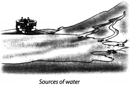
6. The water which we use is obtained from sources such as rivers, lakes, ponds, wells and springs.

7. The two main sources of water on land are glaciers/snow mountains and rain.

8. The largest sources of water on earth are oceans.

9. Water is considered as a renewable resource on the earth.

Water Class 6 Notes Science Chapter 14 2

10. Being highly saline ocean water is not fit for drinking, other domestic purposes, agriculture or industrial uses.

11. The continuous circulation of water from earth’s surface to atmosphere, and from atmosphere back to earth is called water cycle in nature.

12. The process in which a liquid changes to its gaseous state in room temperature also is called evaporation.

13. The loss of water from plants as water vapour through the pores of their leaves is called transpiration.

14. When water vapours rises higher, it cools down, due to the lower temperature at higher altitudes, to form water droplets. This process is known as condensation. When these tiny droplets come together, form clouds.

15. The water which had escaped from the earth as vapour returns to the earth in form of

  • rain
  • snowfall
  • hail.

16. Most of the water that falls on the earth in the form of rain flows down to the oceans. Some of it percolates down into the soil and is available to us as groundwater, well water, tube well water, etc.

17. Process in which water passes through different layers of solid is called infiltration.

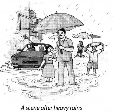
18. When it rains heavily for a long time, we get excess rainfall resulting in too much water all around. This causes floods.

19. A prolonged period of no rains or very low rains, all around, cause shortage of water leading to drought.

Water Class 6 Notes Science Chapter 14 3

20. It is very important that water should be used carefully. We should take care that water should not get wasted.

21. The various ways to conserve water or minimise the wastage of water at home are:

  • Turn off the tap immediately after use.
  • Take bath by filling water in a bucket.
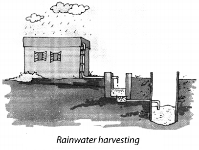
  • Do not use a full flush from the cistern in the toilet. Water harvesting is the activity of collection of rainwater directly by various means.

22. Harvested water can either be used immediately or it can be stored for later use.

Water Class 6 Notes Science Chapter 14 4

23. The two techniques of rainwater harvesting are:

  • Roof top rainwater harvesting.
  • Open Tank/Drain water harvesting.

Class 6 Science Chapter 14 Notes Important Terms

Cloud: The mass of tiny droplets formed by the condensation of water vapour which we see floating high in the atmosphere is called cloud.

Condensation: The changing of water vapour into water on cooling is called condensation.

Drought: An extended period of dryness is called drought.

Evaporation: The process of conversion of water into water vapour is called evaporation.

Flood: An overflow of a large amount of water beyond its normal limits especially over what is normally dry land is called flood.

Groundwater: The water which percolates through the upper layer of the earth’s surface and gets collected on the solid rocks beneath is called groundwater.

Hail: The frozen water from the clouds which falls on the earth in the form of small, round pieces of ice is called hail.

Ocean: The biggest body of water surrounding the 70 per cent of earth’s surface is called ocean.

Rainwater harvesting: The activity of collecting rainwater directly and store it in big tanks for later use is called rainwater harvesting.

Snow: The frozen or solid form of water is called snow.

Water vapour: The gaseous form of the water is called water vapour.

Water cycle: The continuous circulation of water from the earth’s surface to atmosphere and from the atmosphere back to the earth is called water cycle.

NCERT Class 7 History Chapter 9 Notes The Making of Regional Cultures

On this page, you will find NCERT Class 7 History Chapter 9 Notes Pdf free download. CBSE Class 7 Social Science Notes History Chapter 9 SST The Making of Regional Cultures will seemingly help them to revise the important concepts in less time.

The Making of Regional Cultures Class 7 Notes Social Science History Chapter 9

CBSE Class 7 History Chapter 9 Notes Understanding The Lesson

1. India is a vast country. Its rich traditions, cultures, languages, food, clothes, poetry, dances, music and paintings also tend to associate with each region.

2. These traditions and cultures are intermixed. Thus, some traditions appear specific to some regions, others seem to be similar across regions and sometimes older practices take a new form in other regions.

3. The Chera kingdom of Mahodayapuram is one of the best examples of the connection between language and region.

4. Malayalam was spoken in this area and it was used as an official language by the Chera kingdom.

5. In some regions, regional cultures grew around religious traditions. The best example of this process is the cult of Jagannatha (Vishnu) at Puri, Orissa (now Odisha).

6. Anantavarman, ruler of the Ganga dynasty decided to erect a temple for Purushottama Jagannath at Puri.

7. Ananagabhima III dedicated his kingdom to the deity and proclaimed himself as the ‘deputy5 of the god.

8. All those who conquered Orissa, such as the Mughals, the Marathas and the English East India Company, attempted to gain control over the temple. They felt that this would make their rule acceptable to the local people.

9. Rajasthan was called Rajputana by the British. This was an area that was inhabited mainly by the Rajputs, but there were several people other than Rajputs who lived in Rajasthan.

10. State of Rajasthan was ruled by various Rajput families. Prithviraj was one such ruler. These rulers cherished the ideal of the hero who fought valiantly, often choosing death on the battlefield rather than face defeat.

11. Stories about Rajput heroes were recorded in poems and songs which were recited by specially trained minstrels. Ordinary people were also attracted by these stories which often depicted dramatic situations, and a range of strong emotions-loyalty, friendship, love, valour, anger etc.

12. Women are also depicted as following their heroic husbands in both life and death. Those who followed the heroic ideal often had to pay for it with their lives. The practice of sati or the immolation on the funeral pyre of their husbands show their devotion.

13. Kathak was associated with several parts of north India. The term kathak is derived from katha which meant story. The kathaks were originally a caste of storytellers in temples of north India, who embellished their performances with gestures and songs.

14. Kathak began evolving into a distinct mode of dance with the spread of the bhakti movement. The legends of Radha-Krishna were enacted in folk plays called rasa lila, which combined folk dance with the basic gestures of the kathak story-tellers.

15. Under the Mughal emperors, Kathak was performed in the court. It developed in two traditions, one in the courts of Rajasthan (Jaipur) and the other in Lucknow. Under the patronage of Wajid Ali Shah, the last Nawab of Awadh, it grew into a major art form. Kathak, like several other cultural practices, was viewed with disfavor by most British administrators.

16. Miniature painting was also developed in different ways. Miniatures are small-sized paintings and generally done in water color on cloth or paper. The earliest miniatures were on palm leaves or wood.

17. The Mughal emperors Akbar, Jahangir and Shah Jahan patronized highly skilled painters.

18. In the courts of the Deccan and the Rajput courts of Rajasthan, miniature painting developed their distinctive characteristics. Themes from mythology and poetry were depicted at centres such as Mewar, Jodhpur, Bundi, Kota and Kishangarh.

19. Miniature paintings also attracted the state of Himachal Pradesh and developed a bold and intense style called Basohli.

20. The language, Bengali originated from Sanskrit but later on developed its own identity and literature.

21. From 16th century, people migrated in large numbers from less fertile western Bengal to the forested and marshy regions of south-eastern Bengal.

22. A cult of pir became popular in Bengal and their shrines can be found there. Many temples were constructed in Bengal and local deities began to worshipped in temples. Fish and rice are two important foods of the Bengalis. Brahmanas of Bengal also eat fish.

The Making of Regional Cultures Class 7 CBSE Notes Important Terms

Miniature: Miniature is a small-sized painting. These paintings are made with the help of water colour on cloth or paper.

Pir: A Persian word meaning a spiritual guide.

Sati: It is an act of immolation of wife on the funeral pyre of her husband.

Kathak: This is a form of dance together with story.

Rasa Lila: Folk plays of Radha and Krishna.

Gharana: Tradition of classical dance and music.

Lilatilakam: A text of grammar and poetics which took shape in Manipravalam.

Notes of History Class 7 Chapter 9 Time Period

1230: King Anangabhima III dedicated his kingdom to the deity Purushottama Jagannatha and pro­ claimed as the deputy of the God.

1739: Nadir Shah attacked Delhi and conquered it.

NCERT Class 7 History Chapter 8 Notes Devotional Paths to the Divine

On this page, you will find NCERT Class 7 History Chapter 8 Notes Pdf free download. CBSE Class 7 Social Science Notes History Chapter 8 SST Devotional Paths to the Divine will seemingly help them to revise the important concepts in less time.

Devotional Paths to the Divine Class 7 Notes Social Science History Chapter 8

CBSE Class 7 History Chapter 8 Notes Understanding The Lesson

1. People performed various kinds of bhakti and rituals of worship or singing bhajans, kirtans or qawwali or even repeating the name of God in silence.

2. Different groups of people worshipped their own gods and goddesses.

3. The idea that all living things pass through countless cycles of birth and rebirth performing good deeds and bad came to be widely accepted.

4. The belief that social privileges came from birth in a ‘noble’ family or a ‘high’ caste was the subject of many learned texts.

5. Many people turned to the teachings of the Buddha or the Jainas according to which it was possible to overcome social differences and break the cycle of rebirth through personal effort.

6. Others felt attracted to the idea of a Supreme God who could deliver humans free from such bondage if approached with devotion (or bhakit). This idea, advocated in the Bhagavadgita, grew in popularity.

7. The idea of bhakti became so popular that even Buddhists and Jainas adopted these beliefs.

8. New religious movements, led by the Nayanars (saints devoted to Shiva) and Alvars (devoted to Vishnu) emerged 7th to 9th Saints and followers of these religious movements had all castes including untouchable like the Pulaiyar and the Panars.

9. Nayanars and Alvars were sharply critical of the Buddhists and Jainas and preached ardent love of Shiva or Vishnu as the path to salvation.

10. The Nayanars and Alvars went from place to place composing exquisite poems in praise of the deities enshrined in the villages they visited, and set them to music.

11. There were 63 Nayanars, who belonged to different caste backgrounds such as potters, untouchables workers, peasants, hunters, soldiers, Brahmanas and chiefs. The best known among them were Appar, Sambandar, Sundarar and Manikkavasagar. There are two sets of compilations of their songs-Tevaram and Tiruvacakam.

12. There were 12 Alvars, who came from equally divergent backgrounds, the best known being Periyalvar, his daughter Anda, Tondaradippodi Alvar and Nammalvar. Their songs were compiled in the Divya Prabandham.

13. Chola and Pandya kings built huge temples around many of the shrines visited by the saint-poets, strengthening the links between the bhakti tradition and temple worship.

14. One of the most influential philosophers of India Shankara was bom in Kerala in the 8th century. He was an advocate of Advaita or the doctrine of the oneness of the individual soul and the Supreme God which is the ultimate reality. He taught that Brahman, the only or ultimate reality, was formless and without any attributes.

15. Ramanuja, bom in Tamil Nadu in the 11th century, was deeply influenced by the Alvars. Intense devotion to Vishnu was means of attaining salvation. He followed doctrine of Vishishtadvaita. His doctrine greatly inspired the new strand of bhakti which developed in north India subsequently.

16. Virashaiva movement was initiated by Basavanna and his companions Allama Prabhu and Akkamahadev in Karnataka in mid-12th century. They argued strongly for equality of all human beings, opposed Brahmanical ideas on caste and treatment of women. They were also against all forms of ritual and idol worship.

17. Jnaneshwar, Namdev, Eknath, Tukaram, Sakhubai and the family of Chokhamela focused on the bhakti of Vitthala (a form of Vishnu). All these were saints of Maharashtra. They rejected all forms of ritualism, outward display of piety and social differences based on birth. Some saints belonged to lower castes. The idea of renunciation was rejected and preferred to live with their families.

18. Nathpanthis, Siddhacharas and Yogis that emerged during this period criticized the ritual and other aspects of conventional religion and the social order, using simple, logical arguments. They advocated renunciation of the world. To achieve the salvation, they advocated intense training of the mind and body through practices like yogasanas, breathing exercises and meditation. It became popular among ‘low’ castes.

19. Sufis were Muslim mystics. They rejected outward religiosity and emphasized love and devotion to God and compassion towards all fellow human beings. Islam emphasizes monotheism (one God). It rejected idol worship and highlights into collective prayers. Sufis composed poems expressing their feelings and a rich literature in prose, including anecdotes and fables, developed around them.

20. Ghazzali, Rumi and Sadi was the great Sufis in Central Asia and in India there were Khwaja Muinuddin Chishti of Ajmer, Qutbuddin Bakhtiar Kaki of Delhi, Baba Farid of Punjab, Khwaja Nizamuddin Auliya of Delhi and Bandanawaz Gisudaraz of Gulbarga. They developed elaborate methods of training using zikr, contemplation, sama, raqs discussion of parables, breath control etc., under the guidance of a master or pir.

21. The tomb or dargah of a Sufi saint became a place of pilgrimage to which thousands of people of all faiths thronged.

22. In North India, after 13th century there was a new movement of bhakti. Kabir and Baba Guru Nanak rejected all orthodox religions. Otheres like Tulsidas and Surdas accepted existing beliefs and practices.

23. Kabir was brought up in a family of Muslim julahas or weavers near the city of Benares. His ideas are found in the form of sakhis and pads. Kabir’s verses are also in the Guru Granth Sahib, Panch Vani and Bijak which is collection of Kabir’s verses.

24. Kabir’s teachings openly ridiculed all forms of external worship of both Brahmanical Hinduism and Islam, the pre-eminence of the priestly classes and the caste system. The language of his poetry was a form of spoken Hindi widely understood by ordinary people.

25. Tulsidas conceived God in the form of Rama while Surdas in the form of Krishna. Ramcharitmanas was written by Tulsidas in Awadhi language. Sursagara, Surasaravali and Sahitya, Lahari, express devotion of Surdas. He was contemporary of Shankaradeva of Assam who emphasized devotion to Vishnu.

26. Bhakti tradition also included saints like Dadu Dayal, Ravidas and Mirabai. Mirabai was a Rajput princess married into the royal family of Mewar in the 16th century. She was devoted to Krishna and composed innumerable bhajans expressing her intense devotion.

27. The unique feature of most of the saints is that their works were composed in regional languages and could be sung. These transmitted orally by most deprived communities and women.

28. Baba Guru Nanak born at Talwandi (presently in Pakistan). He established a centre at Kartarpur (Dera Baba Nanak) on the bank of river Ravi. The sacred space thus created by Baba Guru Nanak was known as dharmsal. It is now known as Gurdwara.

29. Guru Angad compiled the compositions of Baba Guru Nanak, to which he added his own in a new script known as Gurmukhi. The three successors of Guru Angad also wrote under the name of “Nanak” and all of their compositions were compiled by Guru Aijan in 1604. Later, this holy scripture of the Sikhs called as Guru Granth Sahib. This was authenticated by Guru Gobind Singh.

Devotional Paths to the Divine Class 7 CBSE Notes Important Terms

Virashaivism: A movement initiated by Basavanna and his companions.

Khanqahs: It is a place where people flocked, discussed spiritual matters, sought the blessings of the saints in solving their worldly problems etc.

Hagiography: Hagiography is the writing of saints’ lives.

Dargah: Where the body of Sufi is cremated is called dargah.

Vitthala: A form of Vishnu.

Dharmsal: A sacred space created by Guru Nanak. Now, it is called Gurdwara.

Bhakti: devotion to God.

Sufi: Muslim mystic.

Shariat: Holy law made by the Muslim scholars.

Gurmukhi: A script introduced by Guru Angad.

Notes of History Class 7 Chapter 8 Time Period

1469-1539: Period of Guru Nanak.

1604: All of compositions were compiled by Guru Arjan.

NCERT Class 7 History Chapter 7 Notes Tribes, Nomads and Settled Communities

On this page, you will find NCERT Class 7 History Chapter 7 Notes Pdf free download. CBSE Class 7 Social Science Notes History Chapter 7 SST Tribes, Nomads and Settled Communities will seemingly help them to revise the important concepts in less time.

Tribes, Nomads and Settled Communities Class 7 Notes Social Science History Chapter 7

CBSE Class 7 History Chapter 7 Notes Understanding The Lesson

1. New arts, crafts and production activities flourished in towns and villages.

2. Over the centuries, important political, social and economic developments had taken place.

3. Social change was not the same everywhere, because different kinds of societies evolved differently.

4. Society was already divided according to the rules of vama. The rules of vama was prescribed by the Brahmanas and accepted by the rulers of large kingdoms.

5. The difference between the high and low, and between the rich and poor, increased.

6. Many societies in the subcontinent did not follow the social rules and rituals prescribed by the Brahmanas and nor were they divided into numerous unequal classes. Such societies are often called tribes.

7. Tribes were united by kinship bonds. Tribes obtained their livelihood from agriculture, herders. Some tribes were nomadic and moved from one place to another.

8. A tribal group controlled land and pastures jointly, and divided these amongst households according to its own rules.

9. Many tribes usually lived in forests, hills, deserts and places difficult to reach.

10. The tribes retained their freedom and preserved their separate culture.

11. Caste-based and tribal societies also depended on each other for their diverse needs. This relationship, of conflict and dependence, gradually caused both societies to change.

12. Mostly tribal people did not keep written records, but they preserved rich customs and oral traditions. These were passed down to each new generation.

13. Some powerful tribes controlled large territories. In Punjab, the Khokhar tribe was very influential during the 13th and 14th Later, the Gakkharas became more important. Their chief, Kamal Khan Gakkhar was made a ‘mansabdar’ by Emperor Akbar.

14. Langahs and Arghuns tribals dominated extensive regions in Multan and Sind.

15. The Balochis were another large and powerful tribe in the north-west. They were divided into many smaller clans under different chiefs.

16. In the western Himalaya lived the shepherd tribe of Gaddis.

17. The north-eastern part of the subcontinent too was entirely dominated by tribes—the Nagas, Ahoms and many others.

18. In many areas of present-day Bihar and Jharkhand, Chero Chiefdoms had emerged by the 12th The Mundas and Santals tribes lived in this region and also in Orissa and Bengal.

19. Kolies, Berads and others belonged to Maharashtra highlands and Karnataka.

20. Kolis also lived in many areas of Gujarat.

21. In South, there were large tribal populations of Koragas, Vetars, Maravars and others.

22. The large tribe of Bhils was spread across western and central India. Many of them had become settled agriculturists and some even zamindars.

23. The Gonds were found in great numbers across the present day states of Chhattisgarh, Madhya Pradesh, Maharashtra and Andhra Pradesh.

24. Nomadic pastoralists moved over long distances with their animals. They lived on milk and other pastoral products. They exchanged wool, ghee etc., for grain, cloth, utensils and other products.

25. The Banjaras were the most important trader nomads. Their caravan was called tanda. Sultan Alauddin Khalji used the Banjaras to transport grain to the city markets. They transported food grain for the Mughal army during military campaigns.

26. Many pastoral tribes reared and sold animals such as cattle and horses to the prosperous people.

27. Different castes of petty pedlars also travelled from village to village. They made and sold ropes, reeds, straw matting and coarse sacks.

28. Some castes were entertainers who performed in different towns and villages for their livelihood.

29. Among the Kshatriyas, new Rajput clans became powerful by the 11th and 12th They belonged to different lineages, such as Hunas, Chandelas, Chalukyas and others. Some of these had been tribes earlier. Many of these clans came to be regarded as Rajputs.

30. Some leading tribal families could join the ruling class while many tribes became part of the caste system.

31. The Gonds lived in a vast forested region called Gondwana. They practiced shifting cultivation. They had many clans and each clan had its own raja or rai. In the Akbar Nama it has been mentioned that the Gond kingdom of Garha Katanga had 70,000 villages. The kingdom was divided into garhs. This was further divided into units of 84 villages called chaurasi. The Chaurasi was subdivided into barhots which were made up of 12 villages each.

32. The Ahoms migrated to the Brahmaputra valley from present-day Myanmar in the 13th During the 16th century they annexed the kingdoms of the Chhutiyas and Koch-Hajo and subjugated many other tribes.

33. The Ahoms built a large state and for this they used firearms and high quality gunpowder and cannons.

34. Almost all adult males served in the army during war. There were engaged in building dams, irrigation systems and other public works.

35. The Ahoms also introduced new methods of rice cultivation.

36. The Ahom society was divided into clans or khels and a Khel controlled over several villages.

37. There were very few artisans’ castes, so they came from adjoining kingdoms.

38. The Ahoms worshipped their own tribal gods however, the influence of Brahmanas increased. Temples, Brahmanas, poets and scholars were granted land by the king. In the reign of Sib Singh, Hinduism became the predominant religion, but the Ahom kings did not completely give up their traditional beliefs after adopting Hinduism.

39. Theatre was encouraged. Important works of Sanskrit were translated into the local language. Historical works, known as buranjis were also written first in the Ahom language and then in Assamese.

40. In 1662, the Mughals under Mir Jumla attacked the Ahom kingdom and controlled the region.

Towns, Traders, and Craftsperson Class 7 CBSE Notes Important Terms

Clan: A group of families or households claiming descent from a common.

Nomads: People who are always moving from one place to another for their livelihood.

Tanda: The Caravan of the Banjaras was called tanda.

Itinerant group: Groups of craftspersons, pedlars and entertainers travelling from place to place practicing their different occupations are called itinerant groups.

Shifting cultivation: In the Shifting cultivation trees and bushes in a forest area are first cut and burnt. The crop is sown in the ashes. When this land loses its fertility, another plot of land is cleared and planted in the same way.

Notes of History Class 7 Chapter 7 Time Period

1523: The Ahoms annexed the kingdoms of the Chhutiyas.

1581: The Ahoms annexed the kingdoms of the Koch-Hajo

1591: Raja Man Singh attacked and defeated the Cheros.

1662: Mir Jumla attacked the Ahom kingdom.

NCERT Class 7 Geography Chapter 10 Notes Life in the Deserts

On this page, you will find NCERT Class 7 Geography Chapter 10 Notes Pdf free download. CBSE Class 7 Social Science Notes Geography Chapter 10 SST Life in the Deserts will seemingly help them to revise the important concepts in less time.

Life in the Deserts Class 7 Notes Social Science Geography Chapter 10

CBSE Class 7 Geography Chapter 10 Notes Understanding The Lesson

1. It is very difficult to live on the places where there is no water.

2. Some places are very hot as fire while some are very cold as ice. These are the desert areas of the world.

3. Depending on the temperatures there can be hot desert or cold deserts.

4. The people inhabit these lands wherever little water is available to practice agriculture.

5. Sahara is the world’s largest desert. Sahara desert covers a large part of North Africa. It has an area of around 8.54 millions km.

6. The Sahara desert touches 11 countries. These are Algeria, Chad, Egypt, Libya, Mali, Mauritania, Morocco, Niger, Sudan, Tunisia and Western Sahara.

7. Besides the vast stretches of sands, there are also gravel plains and elevated plateaus with bare rocky surface. These rocky surfaces may be more than 2500m high at some places.

8. The climate of the Sahara desert is scorching hot and parch dry. It has a short rainy season. Days are unbelievable hot, it may be as high as 50°C while nights may be freezing cold with temperatures nearing 0°C

9. Cactus, date palms and acacia etc., are vegetation found in the Sahara desert. In some places there are oasis-green islands with date palms surrounding them.

10. Camels, hyenas, jackals, foxes, scorpions, many varieties of snakes and lizards are the prominent animal species living there.

11. Despite of harsh climate in the Sahara, it is inhabited by various groups of people who pursue different activities. Some nomadic tribes such as Bedounis and Tuaregs live here and rear goats, sheep, camels and horses.

12. The oasis in the Sahara and the Nile Valley in Egypt suppont the settled population. The people grow date palms, rice, wheat, barley and beans. Egyptian cotton, famous worldwide is grown in Egypt.

13. Besides the oil, other minerals of importance that are found in the area include iron, phosphorus, manganese and uranium.

14. Ladakh is a cold desert lying in the Great Himalayas, on the eastern side of Jammu and Kashmir. The Karakoram Range in the north and the Zanskar mountains in the south enclose it. River Indus and Gangri glacier are found in Ladakh.

15. Ladakh is made up of two words-“La” meaning ‘mountain pass’ and “Dak” meaning ‘country’.

16. The altitude (height) in Ladakh varies from about 3000 m in Kargil to more than 8,000m in the Karakoram. Due to its high altitude, the climate is extremely cold and dry. The day temperatures in summer are just above 0°C and the night temperatures well below-30°C. There is little rainfall, as low as 10 cm every year.

17. Due to high aridity in Ladakh, the vegetation is sparse. There are scanty patches of grasses and shrubs for animals to graze. Groves of Willows and poplars are seen in the valleys. Fruit trees such as apples, apricots and walnuts bloom and are found during the summers.

18. Animals like Robins, redstarts, Tibetan snow-cock, raven and hoopoe are found commonly. The animals of Ladakh are wild goats, wild sheep, yak and special kinds of dogs. Yak’s milk is used to make cheese and butter. The hair of the sheep and goat is used to make wollens.

19. In the summer season the people are busy cultivating barley, potatoes, peas, beans and turnip.

20. Leh, the capital of Ladakh is well-connected both by road and air. The National Highway 1A connects Leh to Kashmir Valley through the Zoji la Pass.

21. Tourism is a major activity with several tourists streaming in from within India and abroad. Visits to the gompas, treks to see the meadows and glaciers, witnessing ceremonies and festivities are important activities.

Notes of Geography Class 7 Chapter 10 Important Terms

Desert: A place of extreme hot or extreme cold.

Glaciers: A glacier is a persistent body of dense ice.

NCERT Class 7 History Chapter 6 Notes Towns, Traders, and Craftsperson

On this page, you will find NCERT Class 7 History Chapter 6 Notes Pdf free download. CBSE Class 7 Social Science Notes History Chapter 6 SST Towns, Traders, and Craftsperson will seemingly help them to revise the important concepts in less time.

Towns, Traders, and Craftsperson Class 7 Notes Social Science History Chapter 6

CBSE Class 7 History Chapter 6 Notes Understanding The Lesson

1. Medieval town combined several functions-they were administrative centres, temple towns, as well as centres of commercial activities and craft production.

2. The perennial river Kaveri flows near the beautiful to

wn Thanjavur, which was the capital of the Cholas.

3. Rajarajeshvara temple was built by King Rajaraja Chola. Its architect was Kunjaramallan Rajaraja Perunthachchan who has proudly carved his name on the temple wall.

4. There were palaces where Kings held court in mandaps, issuing orders to their subordinates. There Eire also barracks for the army.

5. The towns were bustling with markets selling grains, spices, cloth and jewellery. Water was supplied in the town from wells and tanks.

6. The Saliya weavers of Thanjavur and the nearby town of Uraiyur were busy producing cloth for flags to be used in the temple festival. They made fine cottons for the king and nobility and coarse cotton for the masses.

7. Some distance away at Svamimalai, the sthapatis or sculptors were making exquisite bronze idols and tall, ornamental bell metal lamps.

8. Thanjavur is also an example of a temple town. This represents a very important pattern of urbanization, the process by which cities developed.

9. Temples were often central to the economy and rulers built temples to demonstrate their devotion to various deities.

10. Kings also donated land for temples and money to carry out elaborate rituals, feed pilgrims and priests and celebrate festivals. Pilgrims also made donations to the temples.

11. Temple authorities used their wealth to finance trade and banking. Gradually a large number of priests, workers, artisans, traders etc., settled near the temple to cater to its needs and those of the pilgrims and thus grew temple towns.

12. Around the temples, Bhillasvamin (Madhya Pradesh) and Somnath (Gujarat), Kanchipuram and Madurai (Tamil Nadu) and Tirupati (Andhra Pradesh) towns were developed.

13. Pilgrimage centres also developed into townships. Vrindavan (Uttar Pradesh), and Tiruvannamalai (Tamil Nadu) are examples of two such towns.

14. Ajmer was the capital of the Chauhan kings in the 12th century and later became the suba headquarters under the Mughals. Khwaja Muinuddin Chishti, who is famous Sufi Saint, settled there in 12th century, attracted devotees from all creeds.

15. From the 8th century onwards there were several small towns in the subcontinent. These towns probably emerged from the large villages. They usually had a mandapika (mandi or market) where villagers brought their produce to sell. They also had market streets called hatta (haat) lined with shops. There were different streets for different items.

16. Usually a samanta or a zamindar built a fortified palace in or near these towns. They levied taxes on traders, artisans and articles of trade and sometimes ‘donated’ the ‘right’ to collect these taxes to local temples, which had been built by themselves or by rich merchants.

17. Taxes were collected in kind or in cash. Taxes were taken on sugar and jaggery, dyes, thread, cotton, on coconuts, salt, butter, sesame oil, on cloth, metal goods, distillers, cattle fodder and on loads of grain.

18. There were many kinds of traders. Gujarati traders, including the communities of Hindu Baniyas and % Muslim Bohras, sold textiles and spices and brought gold and ivory from Africa and spices, tin, Chinese blue pottery and silver from Southeast Asia and China.

19. Spices such as pepper, cinnamon, nutmeg, dried ginger etc., grown in tropical climates became an important part of European cooking and cotton cloth was very attractive.                                      ‘

20. The craftspersons of Bidar were so famed for their inlay work in copper and silver that it came to be called Bidri.

21. The Panchalas or Vishwakarma community, consisting of goldsmiths, bronzesmiths, blacksmiths, masons and carpenters were essential to the construction of buildings of temples, palaces, big buildings, tanks and reservoirs.

22. Weavers such as the Saliyar or Kaikkolars emerged as prosperous communities making donations to temples. Cloth making like cotton cleaning, spinning and dyeing became specialized and independent crafts.

23. Hampi is located in the Krishna-Tungabhadra basin, which formed the nucleus of the Vijayanagara Empire, founded in 1336. It is a well-fortified city. No mortar or cementing agent was used in the construction of these walls and technique followed was to wedge them together by interlocking.

24. Hampi was a busy place with commercial and cultural activities. Moors (Muslim merchants), Chettis and European traders joined the markets of Hampi.

25. Devadasis performed before the deity, royalty and masses in the Virupaksha (a form of Shiva) temple.

26. The Mahanavami festival (now known as Navaratri) was one of the most important festivals celebrated at Hampi. King also participated in the Mahanavami festival and received guests and accepted tribute from subordinate chiefs.

27. Hampi fell into ruin following the defeat of Vijayanagara in 1565 by the Deccani Sultans—the rulers of Golconda, Bijapur, Ahmadnagar, Berar and Bidar.

28. Surat (Gujarat) was the emporium of western trade during the Mughal period along with Cambay (Khambat) and somewhat later, Ahmedabad. Surat was the gateway for trade with West Asia via the Gulf of Ormuz.

29. Surat hits also been called the gate to Mecca because many pilgrims used this place to visit Mecca.

30. In the Surat city, there was cosmopolitan culture and people of all castes and creeds lived there. In 17th century there were many factories and warehouses at Surat. On an average a hundred ships of different countries could be found at the port at any time.

31. In Surat, there were several retail and wholesale shops selling cotton textiles. The textiles of Surat were famous for their gold lace borders (zari) and had a market in West Asia, Africa and Europe. There were rest-houses, magnificent buildings and innumerable pleasure parks.

32. The Kathiawad seths or mahajans had huge banking houses at Surat. It is noteworthy that the Surat hundis were honoured in the far-off markets of Cairo in Egypt, Basra in Iraq and Antwerp in Belgium.

33. However, Surat began to decline towards the end of the 17th century due to many factors.

34. The English, Dutch and French formed East India Companies in order to expand their commercial activities in the east.

35. Great Indian traders like Mulla Abdul Ghafur and Viiji Vora who owned a large number of ships competed with them.

36. Bombay, Calcutta and Madras rise in 18th century, which are nodal cities today.

37. Vasco da Gama was a Portuguese sailor and Christopher Columbus was an Italian sailor.

Towns, Traders, and Craftsperson Class 7 CBSE Notes Important Terms

Emporium: A place where goods from diverse productions are bought and sold.

Hundi: Hundi is a note recording a deposit made by a person. The amount deposited can be claimed in another place by presenting the record of the deposit.

Temple Town: A town where many temples existed.

Factor: An official merchant of the East India Company.

Notes of History Class 7 Chapter 6 Time Period

1336: Vijayanagara Empire was founded.

1565: Vijayanagara Empire was defeated.

17th century: Masulipatnam was a centre of intense activity. *In the last of 17th century Surat began to decline.

NCERT Class 7 Civics Chapter 9 Notes Struggles for Equality

On this page, you will find NCERT Class 7 Civics Chapter 9 Notes Pdf free download. CBSE Class 7 Social Science Notes Civics Chapter 9 SST Struggles for Equality will seemingly help them to revise the important concepts in less time.

Struggles for Equality Class 7 Notes Social Science Civics Chapter 9

CBSE Class 7 Civics Chapter 9 Notes Understanding The Lesson

1. The Indian constitution recognizes all Indians as equal before the law and states. No person can be discriminated on any ground.

2. All adults in India have the equal right to vote during elections and this power has been used by people to elect or replace their representatives.

3. The vote of one person is as good as that of another.

4. Poverty and the lack of resources are the key reasons for inequality in India.

5. Discrimination on the basis of a person’s religion, caste and sex is another significant factor for why people are treated unequally in India.

6. Dalit, Adivasi and Muslim girls drop out of school in large numbers. This is a combined outcome of poverty, social discrimination and the lack of good quality school facilities for these communities.

7. In each community and in society there are some respectable people who fight of equality. They may be well-respected because they treat all persons with dignity and are, therefore, trusted and play an important role to resolve issues in the community.

8. In India, there are several struggles in which people have come together to fight for issues that they believe are important.

9. There are many such struggles such as those among beedi workers, fisher-folks, agricultural labourers, slum-dwellers and each group is struggling for justice in its own way.

10. Many times they form cooperatives or other collective ways by which people can have more control over resources.

11. In the villages adjoining to the forest areas, when sanctuaries for animals are constructed, many poor people are displaced and people are forced to go and build new homes and new lives.

12. In urban areas, bastis in which poor people live are often displaced to the areas located outside of the city. Displaced poor people are severely disrupted.

13. There are several organizations across the country fighting for the rights of the displaced.

14. Tawa Matsya Sangh-a federation of Fisherworker’s cooperatives-an organization fighting for the rights of the displaced forest-dwellers of the Satpura forest in Madhya Pradesh.

15. The Tawa, originating in the Mahadeo hills of Chindwara district, flows through Betul, before joining the Narmada in Hoshangabad.

16. The Tawa dam began to be built in 1958 and was completed in 1978. It submerged large areas of forest and agricultural land. People of 33 villages were displaced. Some of the displaced people settled around the reservoir and apart from their meager farms, found a livelihood in fishing.

17. In 1994, the government gave the rights for fishing in the Tawa reservoir to private contractors. These contractors got cheap labour from outside. The villagers stood united and decided to set up an organization to protect their livelihood rights. Thus, they formed Tawa Matsya Sangh (TMS). And after long struggles they were granted right to fishing for their livelihood by the Madhya Pradesh government in 1996.

18. For the upliftment of the needs of fishermen, Tawa Matsya Sangh played a great role to make them able to increase their earning substantially. The Sangh arranges for fair price, transport, selling in a market where they get a good price, loans to fishermen for repair and the buying of new nets etc. Thus, the fisher­men have started to earn three times more than they earned earlier.

19. A dam is built across a river at sites where it can collect a lot of water. Dam submerges vast areas of land. The Tehri dam, Uttarakhand submerged old Tehri town and 100 villages. Nearly one lakh people were displaced from the construction of Tehri dam.

20. The Indian Constitution provides equality of all persons. Issues of equality are central to a democracy.

21. The privatization of health services in the country, the increasing control that business houses exert on the media, the low value given to women and their work, and the low earning made by small farmers who grow cotton are the issues that substantially affect poor and marginalized communities, and therefore, concern economic and social equality in the country.

22. The dignity and self-respect of each person and their community can only be realized if they have ad­equate resources to support and nurture their families and if they are not discriminated against.

Struggles for Equality Class 7 CBSE Notes Important Terms

Dam: Dam is built between the river to collect a lot of water.

Reservoir: A large natural or artificial lake used as a source of water supply.

TMS: TMS stands for Tawa Matsya Sangh which is an organization formed for betterment of affected fishermen.

Creative expression: Those who use their pen, or their voice, or their ability to dance to draw attention to issues are called creative artists. Their expressions and methods are called cre­ative expressions.

NCERT Class 7 Geography Chapter 9 Notes Life in the Temperate Grasslands

On this page, you will find NCERT Class 7 Geography Chapter 9 Notes Pdf free download. CBSE Class 7 Social Science Notes Geography Chapter 9 SST Life in the Temperate Grasslands will seemingly help them to revise the important concepts in less time.

Life in the Temperate Grasslands Class 7 Notes Social Science Geography Chapter 9

CBSE Class 7 Geography Chapter 9 Notes Understanding The Lesson

1. Forest can be defined as the place where trees are the main type of vegetation. Similarly, grassland can be defined as a region where grasses form the dominant type of plant life.

2. Grasslands make up almost a quarter of the total land surface.

3. The types of plants or grasses are dependent on the climate and soil. ‘

4. The world’s grasslands can be divided into two broad categories-temperate and tropical regions grasslands.

5. The temperate grasslands of North America are known as the Prairies. It is a region of flat, gently sloping or hilly land. Tallgrass, upto two metres high, dominates the landscape. Most part of prairies is treeless.

6. The prairies are bound by the Rocky Mountains in the West and the great lakes in the East. Prairies cover parts of United States of America and parts of Canada. In the USA, the area is drained by the tributaries of Mississippi and the Canadian prairies are drained by the tributaries of Saskatchewan Rivers.

7. The climate is of continental type with extreme temperatures. The summers are warm with temperatures of around 20°C, while in winter -20°C has been recorded in Winnipeg, Canada. In winters a thick blanket of snow covers this region.

8. The annual rainfall is moderate and is ideal for the growth of grass. A local wind “Chinook” blows here.

9. Prairies are practically tree-less. Where water is available, trees such as willows, alders and poplars grow.

10. Places that receive rainfall of over 50 cm, are suitable for farming as the soil is fertile. The major crop of this area is maize, other crops including potatoes, soybean, cotton and alfa-alfa are also grown.

11. Prairies are suitable for cattle rearing. Large cattle farms are called ‘ranches’. Bison or the American buffalo is the most important protected animal of this region. The other animals found in this region are rabbits, coyotes, gophers and prairie dog.

12. The people of the Prairies region are very hard-working. Two of the most developed countries in the world-the USA and Canada are located in this region. Scientific methods of cultivation and use of tractors, harvesters and combines have made North America a surplus food producer.

13. The Prairies are also known as the “Granaries of the world,” due to the huge surplus of wheat production.

14. In the Prairies region dairy farming is another major industry. Dairy farming and extensive agriculture both promote setting up of food processing industries.

15. Large mineral deposits particularly coal and iron are found in this region. A good network of roads, railways and canals in this region has made it the most industrialized region in the world.

16. The temperate grasslands of South Africa are called the velds. Velds are rolling plateaus with varying heights ranging from 600 m to 1100 m. It is bound by the Drakensburg Mountains on the east. To its west lies the Kalahari Desert. On the northeastern part, “height velds’ are located that attain a height of more than 1600m, in some places.

17. The tributaries of rivers Orange and Limpopo drain the region.

18. The velds have a mild climate due to the influence of the Indian Ocean. Winters are cold and dry. Temperatures vary between 5°C and 10°C July is the coldest mouth. Summers are short and warm.

19. The velds receive rainfall mainly in the summer months from November to February.

20. The vegetation cover is sparse. Grasses dominate the landscape. Red grass grows in bush velds. In the high velds acacia and maroola are seen to be growing.

21. The animals of the velds are primarily lions, leopards, cheetah and kudu.

22. In the velds region the main crops are maize, wheat, barley, oats and potato. Cash crops like tobacco, sugar cane and cotton are also grown.

23. In the velds regions, sheep rearing is the most important occupation of the people. Sheep has given rise to the wool industry in the velds. Merino sheep is a popular species and its wool is very warm.

24. Dairy farming is the next important occupation. Cattle are reared in the warmer and wetter regions and the dairy products like butter, cheese are produced for both domestic supply and also for export.

25. The velds have rich reserve of minerals. Iron and steel industry has developed where coal and iron are present. Gold and diamond mining are major occupations of people of this region.

26. Johannesburg is known for being the gold capital of the world. Kimberley is famous for its diamond mines. The mineral rich area has a well-developed network of transport.

Notes of Geography Class 7 Chapter 9 Important Terms

Grasslands: A region where grasses form as a dominant type of plant life.

Veld: The temperate grasslands of South Africa are called the velds.

Prairie: The word originated from Latin word priata which means meadow.

Ranches: Large cattle farms are called ‘ranches’

Cowboys: The men who look the ranches.

Bison: The American buffalo.

Chinook: A type of hot wind that blows in winter.